S Airde Beinn - GM/SI-153 SOTA (2025)
Summits on the Air Activation Report
Activation Date: Thursday 23rd October, 2025.
Activator(s): Richard M1HAX.
Summit: S Airde Beinn, Scottish Islands, Scotland.
Summit ID: SOTA reference GM/SI-153 (1 point).
Summit Height: 295m elevation, 153m prominence.
Summit Location: Lat./Long. 56.60638, -6.12277. Maidenhead Grid IO66wo.
Distance: 2.6km travelled with 141m of ascent.
Difficulty: SAC Grade T2.(?)
Elapsed Time: 1h 15m (including operating).
Weather: 10°C, sunny, 24kph W wind, 74% humidity.
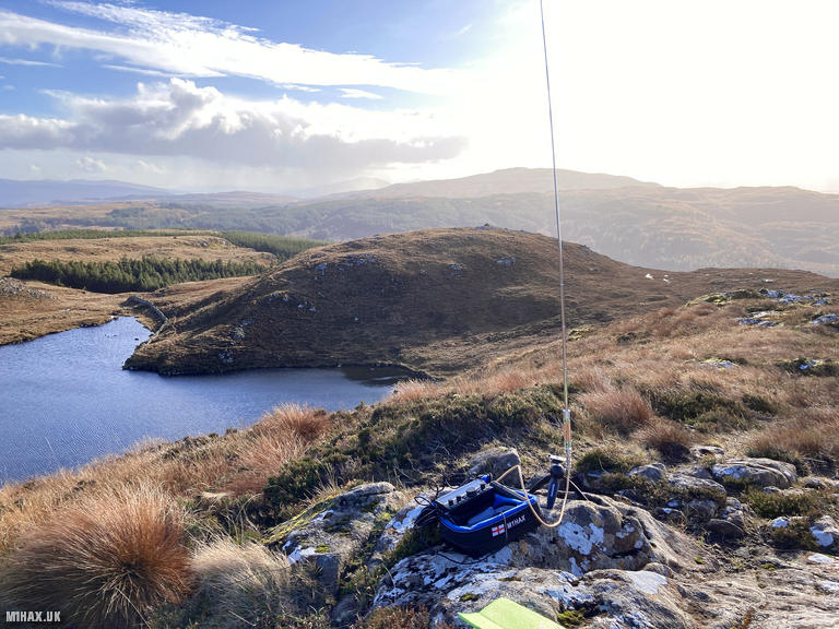
Radio Equipment: Elecraft KX2, Elecraft AX1.
Callsign Used: MM1HAX/P.
Contacts: 22 (20m SSB).
Trip Notes
S Airde Beinn (pronounced approximately “sarsje bine”) rises to 295 metres near the Mishnish Lochs, a short drive west of Tobermory on the Isle of Mull. This distinctive hill is a volcanic plug - the eroded remnant of a magma conduit that supplied lava flows across this region approximately 60 million years ago during the Paleocene volcanic period. The summit is of national geological interest, featuring rare minerals including larnite, rankinite and wollastonite, formed through thermal metamorphism as the molten rock baked the surrounding strata.
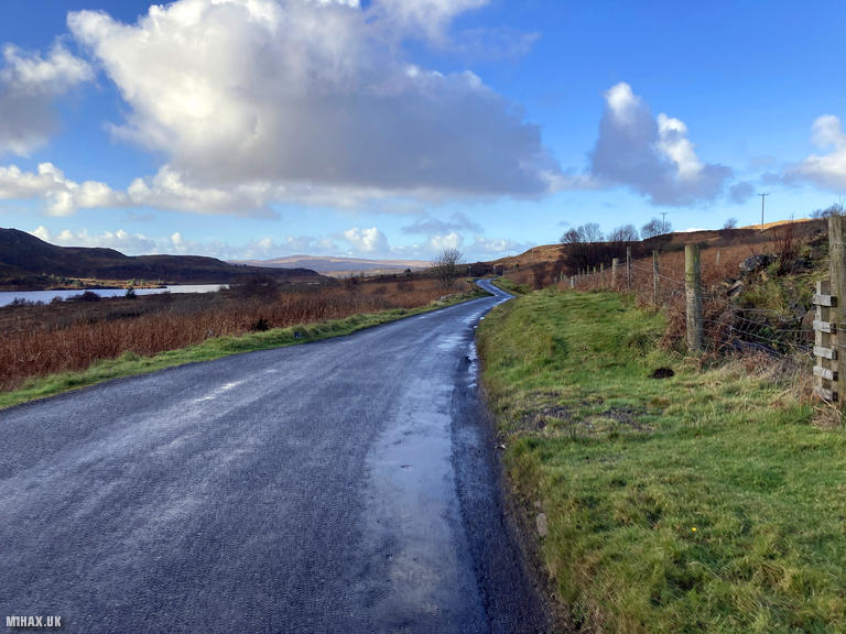
This was my favourite small hill walk during our Scottish family holiday. The starting point is a roadside layby on the B8073 Tobermory to Dervaig road, adjacent to a ruined cottage. If this is full, an old quarry approximately 500 metres back towards Tobermory provides alternative parking.
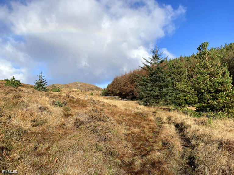
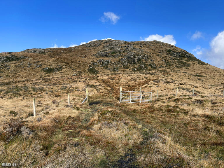
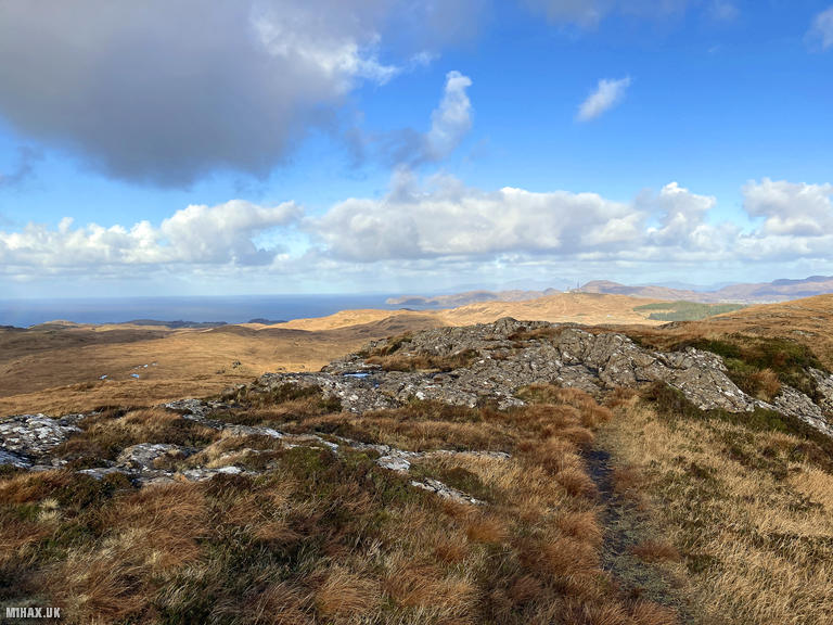
The walking route is straightforward, following a grassy trail almost due north towards the obvious summit. The weather today was clear and we enjoyed excellent views throughout much of the walk. The route underfoot proved wet and boggy in places but never desperate. Passing through an open gate, the trail continues upwards over increasingly rocky and less waterlogged terrain.
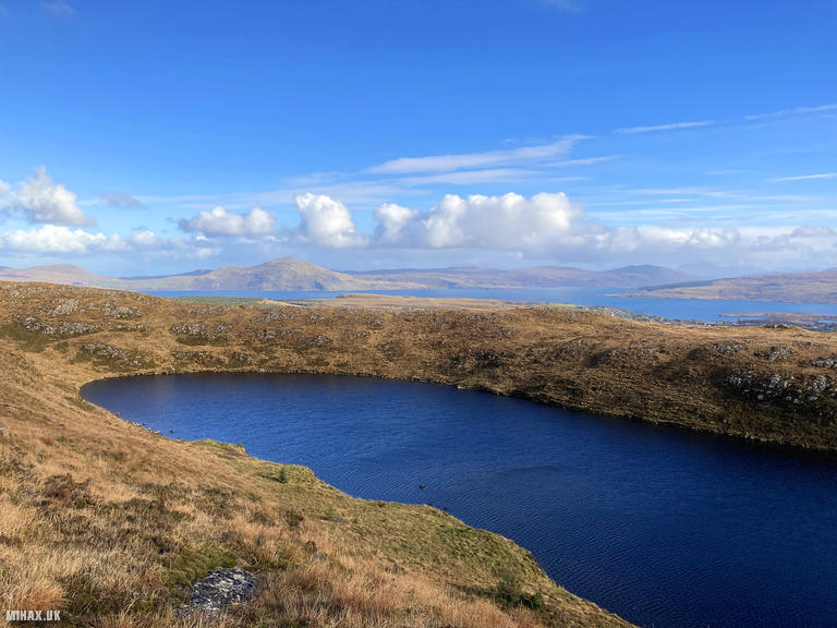
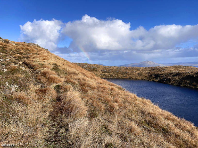
The geological highlight comes upon reaching the summit ridge, where the volcanic caldera reveals itself - a stunning hidden loch (Lochan ‘S Airde Beinn) sits within the crater, completely invisible until the final approach. It is possible to walk a circular route around the crater rim, but in the interests of time I stopped at the high point on the western side where a small cairn marks the summit.
Using my AX1 compromise antenna I worked a satisfying 22 stations on 20 metres while enjoying the beautiful landscape. Views extended across the Sea of the Hebrides to Rum, Eigg, Coll and Ardnamurchan. On exceptionally clear days Ben Nevis is visible to the east. Regular chasers including EA1DHB, OH3GZ and S57S were among those worked, with the latter providing a strong 59 signal report from Slovenia.
After packing away we returned down the same route to the car, completing the circuit in just over an hour. If you are visiting Tobermory then this aesthetically pleasing Marilyn is absolutely worth the minimal effort required. The combination of volcanic geology, hidden crater lake and panoramic island views makes it one of northern Mull’s finest short walks.
Photos
Below are some photographs taken during my activation of S Airde Beinn on Thursday 23rd October, 2025.

Walking Route for S Airde Beinn
The interactive map below shows my GPS track taken to the SOTA activation zone for S Airde Beinn. The GM/SI-153 summit area is marked on the map with a blue pin icon.
You can download the route shown above as a GPX file suitable for use with most GPS devices. This file is provided for information only, to support your own walk planning and research (it may contain navigation errors, detours and/or safety hazards). The route downloads provided here are governed by the Creative Commons BY-NC-SA 4.0 licence.
Station Log
I logged the following 22 amateur radio contacts operating as MM1HAX/P from GM/SI-153 S Airde Beinn on Thursday 23rd October, 2025 (all times shown are UTC):
| Time | Callsign | Band | Mode | Notes |
|---|---|---|---|---|
| 10:40 | EA1DHB | 20m | SSB | RSTr: 55, RSTs: 58 |
| 10:41 | LA5FHA | 20m | SSB | RSTr: 53, RSTs: 52 |
| 10:41 | M0DLL | 20m | SSB | RSTr: 33, RSTs: 55 |
| 10:42 | S57S | 20m | SSB | RSTr: 59, RSTs: 58 |
| 10:43 | 2E0FEH | 20m | SSB | RSTr: 55, RSTs: 57 |
| 10:44 | OE6RCD | 20m | SSB | RSTr: 42, RSTs: 51 |
| 10:45 | EA1BUL | 20m | SSB | RSTr: 57, RSTs: 58 |
| 10:45 | OK2PDT | 20m | SSB | RSTr: 57, RSTs: 56 |
| 10:46 | I0KHY | 20m | SSB | RSTr: 55, RSTs: 54 |
| 10:47 | DL9NCI | 20m | SSB | RSTr: 54, RSTs: 55 |
| 10:47 | EA2CPG | 20m | SSB | RSTr: 55, RSTs: 58 |
| 10:47 | SP2DMB | 20m | SSB | RSTr: 53, RSTs: 57 |
| 10:49 | M7EFA | 20m | SSB | RSTr: 54, RSTs: 57 |
| 10:50 | SP3ATB | 20m | SSB | RSTr: 54, RSTs: 57 |
| 10:50 | OH3GZ | 20m | SSB | RSTr: 59, RSTs: 57 |
| 10:51 | I1WKN | 20m | SSB | RSTr: 55, RSTs: 53 |
| 10:52 | DL1XBB | 20m | SSB | RSTr: 58, RSTs: 56 |
| 10:53 | F4ABI | 20m | SSB | RSTr: 44, RSTs: 53 |
| 10:53 | DL1DBB | 20m | SSB | RSTr: 55, RSTs: 59 |
| 10:54 | DL4DBM | 20m | SSB | RSTr: 57, RSTs: 58 |
| 10:54 | S57ILF | 20m | SSB | RSTr: 33, RSTs: 44 |
| 10:55 | G0FIU | 20m | SSB | RSTr: 59, RSTs: 54 |
In the notes field I will usually log the other operator’s name and the signal report they provided. In accordance with the Summits on the Air rules, I do not make a log entry where a complete exchange of callsigns and signal reports was unsuccessful.
Additional Information
The following resources may be helpful to walkers, mountaineers and SOTA activators interested in S Airde Beinn:
- Sotl.as Summit Page for GM/SI-153 S Airde Beinn.
- Hill Bagging UK Summit Page for S Airde Beinn.
- Google Maps Page for S Airde Beinn.
- Wikipedia entry for S Airde Beinn.
If you found this content valuable, why not Buy Me a Coffee?