See Morris Hill - GM/SS-274 SOTA (2025)
Summits on the Air Activation Report
Activation Date: Saturday 25th October, 2025.
Activator(s): Richard M1HAX.
Summit: See Morris Hill, Southern Scotland, Scotland.
Summit ID: SOTA reference GM/SS-274 (1 point).
Summit Height: 240m elevation, 150m prominence.
Summit Location: Lat./Long. 55.08391, -3.72018. Maidenhead Grid IO85dc.
Distance: 1.9km travelled with 106m of ascent.
Difficulty: SAC Grade T1.(?)
Elapsed Time: 45m (including operating).
Weather: 5°C, sunny, 26kph NW wind, 79% humidity.
Radio Equipment: Elecraft KX2, Elecraft AX1.
Callsign Used: MM1HAX/P.
Contacts: 5 (17m SSB).
Trip Notes
See Morris Hill rises to 240 metres in the parish of Terregles, near Dumfries in southwest Scotland. The surrounding area has deep historical roots - the name Terregles derives from Cumbric (the ancient Brittonic language once spoken here), recorded as Travereglis in 1359, meaning “settlement of the church” from trev-ir-egles. The nearby Terregles House was once the seat of the Maxwell family, Earls of Nithsdale, whose turbulent history includes involvement in the 1715 Jacobite Rising.
On the return journey from our Scottish holiday, we stayed overnight in Ayrshire to break up the long drive south. I identified See Morris Hill as a good candidate for a quick activation as it is one of the more frequently visited SOTA summits in the region, given its straightforward access.
The approach turns off Terregles Road onto a rural lane, reaching a roadside area suitable for parking several cars. Take care not to block the drive to the nearby cottage or any farm gates. From here a gated access road heads across farmland to reach a transmitter mast at the summit. Historically other visitors have reported being able to drive beyond the gate, however it was locked today.
The walking is easy and straightforward, following the access road up gentle inclines. Unfortunately, in the upper field a large herd of cattle blocked the track. Not wanting to disturb them, we took a detour across the field on a bearing directly up to the cattle grid by the transmitter compound.
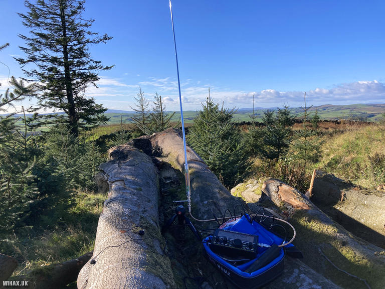
The activation zone is generous on this summit. I chose not to continue to the trig point (which features a rock with a carved arrow) but instead operated from a fallen tree near the transmitter entrance. After some quick contacts on the 17-metre band including a summit to summit with IK2LEY/P on Monte Crocione (I/LO-284) in Italy - I packed away and followed my diversionary route in descent to successfully avoid the cattle again.
As we neared the car, we passed a couple walking up who may have been the farmers, though we did not stop to chat. See Morris Hill is not a hill I would necessarily revisit given the livestock presence and large number of alternatives in this region, but definitely a pleasant enough walk with good views across Nithsdale to Criffel and the Solway coast.
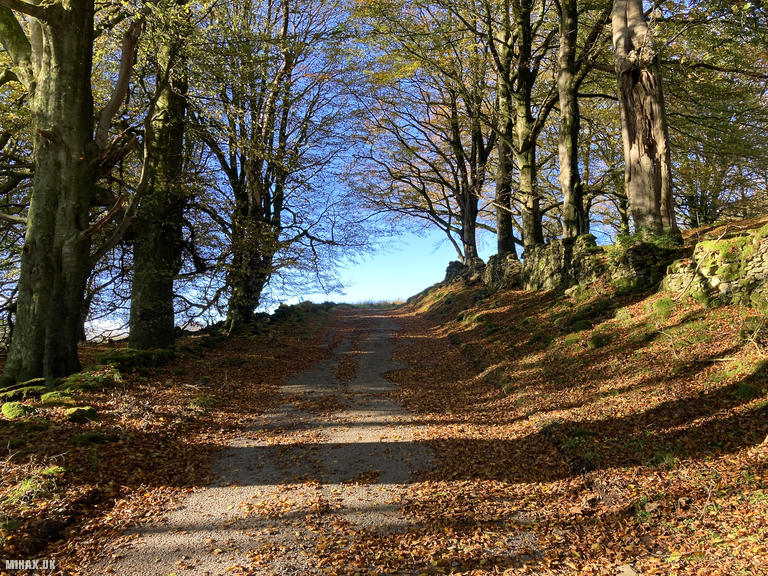
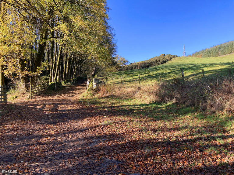
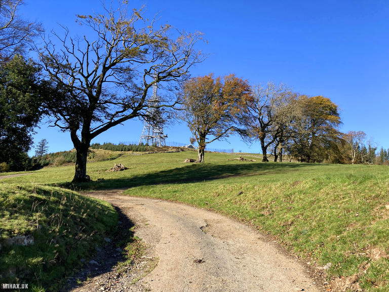
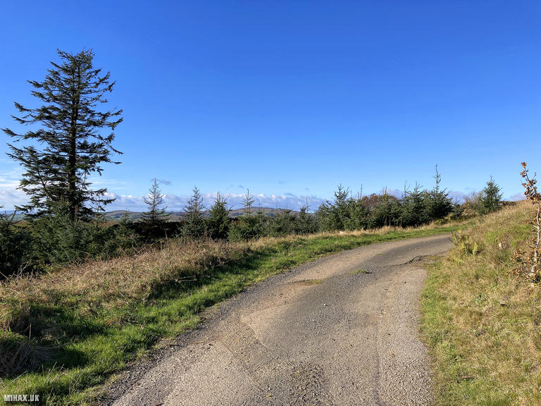
Photos
Below are some photographs taken during my activation of See Morris Hill on Saturday 25th October, 2025.

Walking Route for See Morris Hill
The interactive map below shows my GPS track taken to the SOTA activation zone for See Morris Hill. The GM/SS-274 summit area is marked on the map with a blue pin icon.
You can download the route shown above as a GPX file suitable for use with most GPS devices. This file is provided for information only, to support your own walk planning and research (it may contain navigation errors, detours and/or safety hazards). The route downloads provided here are governed by the Creative Commons BY-NC-SA 4.0 licence.
Station Log
I logged the following 5 amateur radio contacts operating as MM1HAX/P from GM/SS-274 See Morris Hill on Saturday 25th October, 2025 (all times shown are UTC):
| Time | Callsign | Band | Mode | Notes |
|---|---|---|---|---|
| 10:35 | IK2LEY/P | 17m | SSB | RSTr: 57, RSTs: 56, S2S I/LO-284 |
| 10:36 | EA8DMZ | 17m | SSB | RSTr: 53, RSTs: 57 |
| 10:36 | SQ9MDF | 17m | SSB | RSTr: 56, RSTs: 56 |
| 10:36 | SQ9NOT | 17m | SSB | RSTr: 56, RSTs: 56 |
| 10:41 | DL6MST | 17m | SSB | RSTr: 54, RSTs: 54 |
In the notes field I will usually log the other operator’s name and the signal report they provided. In accordance with the Summits on the Air rules, I do not make a log entry where a complete exchange of callsigns and signal reports was unsuccessful.
Additional Information
The following resources may be helpful to walkers, mountaineers and SOTA activators interested in See Morris Hill:
- Sotl.as Summit Page for GM/SS-274 See Morris Hill.
- Hill Bagging UK Summit Page for See Morris Hill.
- Google Maps Page for See Morris Hill.
- Wikipedia entry for See Morris Hill.
If you found this content valuable, why not Buy Me a Coffee?