Ta' Dmejrek - 9H/MA-001 SOTA (2025)
Summits on the Air Activation Report
Activation Date: Tuesday 25th November, 2025.
Activator(s): Richard M1HAX.
Summit: Ta' Dmejrek, Malta, Malta.
Summit ID: SOTA reference 9H/MA-001 (1 point).
Summit Height: 253m elevation, 253m prominence.
Summit Location: Lat./Long. 35.85280, 14.38350. Maidenhead Grid JM75eu.
Distance: 0.8km travelled with 10m of ascent.
Difficulty: SAC Grade T1.(?)
Elapsed Time: 55m (including operating).
Weather: 19°C, sunny, 28kph SSW wind, 64% humidity.
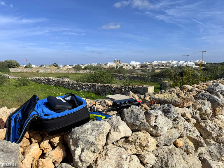
Radio Equipment: Elecraft KX2, EFHW.
Callsign Used: 9H/M1HAX/P.
Contacts: 16 (20m SSB).
Trip Notes
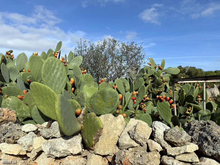
Ta' Dmejrek holds the distinction of being Malta’s highest point, yet it must rank among the most unusual summits in the entire SOTA programme. At 253 metres, the elevation is only realised because the limestone plateau drops away dramatically to the Mediterranean Sea along the Dingli Cliffs to the south. The immediate area is remarkably flat, so much so that the exact location of the true summit remains somewhat ambiguous. This peculiarity creates an unusually large activation zone, and discussions on the SOTA Reflector confirm that activators have successfully operated from various points along the cliff road. The summit’s full prominence of 253 metres qualifies it comfortably for SOTA, though calling it a mountain requires a generous interpretation of the term.
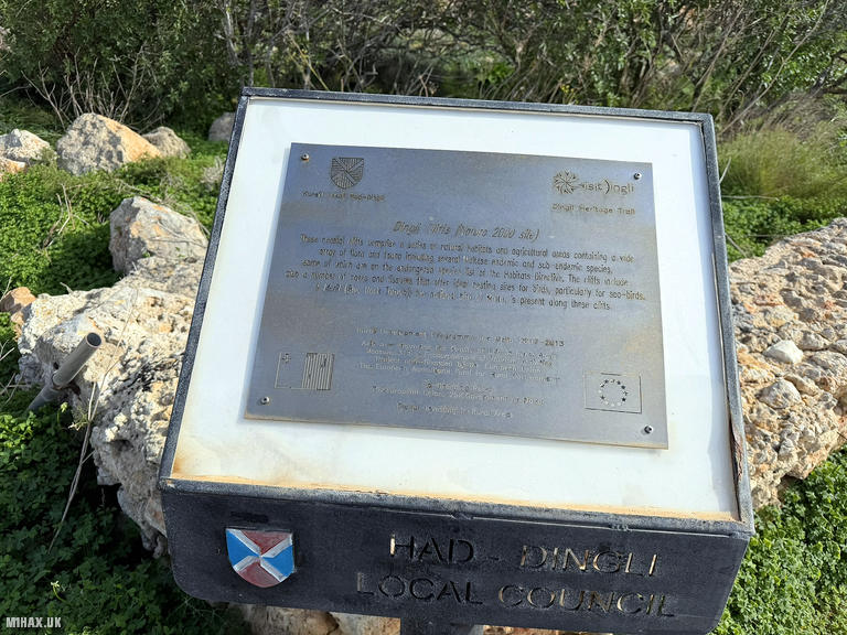
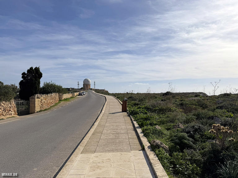
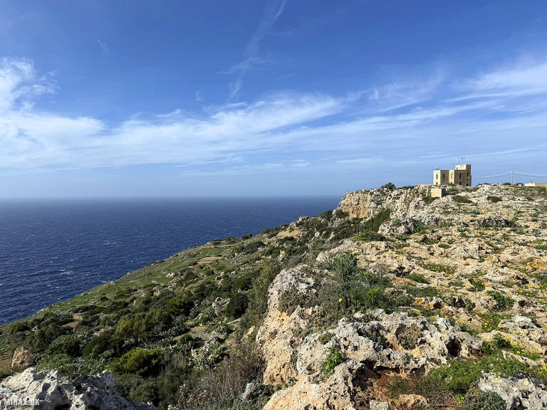
The area has significant historical interest beyond its topographical curiosity. Malta’s first radar station was established at Dingli on 27th March 1939, and during the Second World War the British military constructed an underground complex here. The distinctive white radome visible today, known locally as “Il-Ballun” (The Balloon), now serves civil aviation purposes, managing air traffic across the Malta Flight Information Region. The Dingli Cliffs themselves stretch over five kilometres along the southwestern coast, their sheer faces once providing natural defence against Mediterranean pirates.
I was staying in Valletta for a short holiday and wanted to activate Ta' Dmejrek using public transport. Since 2021, Malta has made provisions for visiting radio amateurs holding CEPT equivalent qualifications to operate without applying for a separate licence, provided the stay does not exceed three months. When transmitting, the visiting operator must use their national callsign preceded by the prefix “9H”, hence my operation as 9H/M1HAX/P.
The number 52 bus runs hourly between the bus station in Valletta and Dingli village. The journey took almost an hour, passing through Mdina on the way. Once we left the bustling streets of Valletta behind, the inexpensive bus was quiet and punctual. The route through the Maltese countryside offered glimpses of terraced fields, parish churches, and the impressive bastion of Mdina perched on its hilltop.
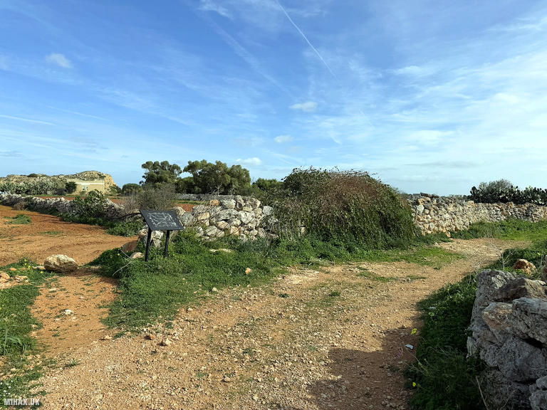
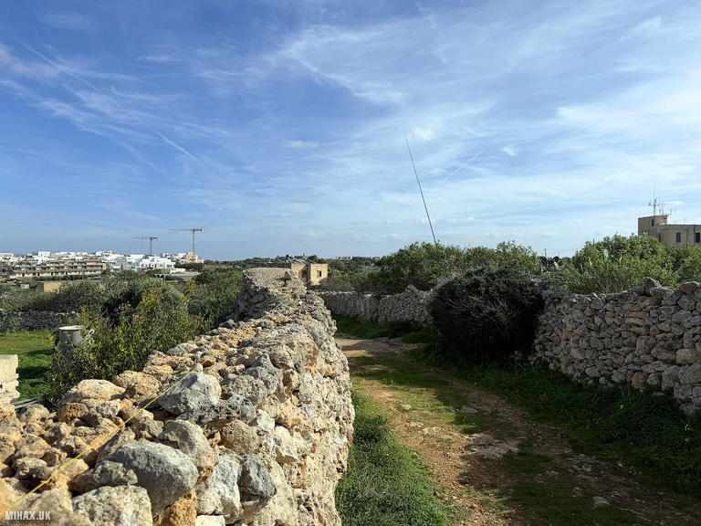
We departed the bus at its terminus outside the curiously named Bobbyland Restaurant. From here, we walked a short distance along the main road heading southeast. After perhaps 300m, a dirt track appeared on the left side of the road, and I decided to set up here, using the traditional Maltese stone walls as convenient supports for my radio equipment.
Setting up the Elecraft KX2 with an end-fed half-wave antenna, I began calling on 20 metres SSB at 10:42 UTC. The response was immediate and enthusiastic. Within eleven minutes I had logged sixteen contacts, the 9H prefix clearly generating interest among European chasers. Stations from Spain, Italy, Greece, Germany, Switzerland, Austria, Slovenia, and the Balearic Islands all made it into the log. The highlight was a faint summit-to-summit contact with SP6FEN/P operating from Kraglak (SP/SS-016).
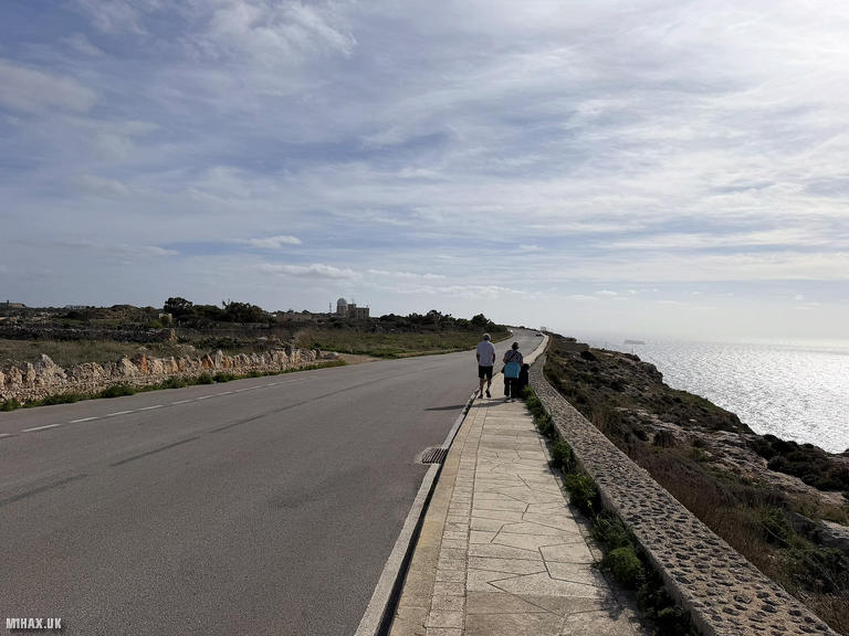
After exhausting the pile-up, I packed away the equipment and walked back to the main road. Rather than returning immediately to the bus stop, we continued towards the radar installation, passing a small military building. Along this stretch of road there are excellent views across the sea to the uninhabited island of Filfla, and several seating benches which appeared to be just within the activation zone. I noted that descending the trail towards the sea would almost immediately exit the valid activation area. The true summit lies to the immediate northeast of the radar dome, however, given my recent experience operating next to a radar installation in Madeira on CT3/MI-004, I was keen to maintain some distance to avoid any potential interference with my radio.
We took the bus back towards Valletta, stopping in Mdina for lunch on the way. This ancient fortified city, known as “The Silent City” because only a few hundred residents live within its walls, was Malta’s capital until the Knights of St John relocated to Birgu in 1530. The narrow limestone streets, free from cars, provided a wonderfully atmospheric setting to reflect on a successful activation of one of SOTA’s more unusual summits.
This activation demonstrates that Summits On The Air participation need not always involve strenuous hillwalking. Ta' Dmejrek offers straightforward access via public transport, simple licensing under CEPT provisions, and genuine DX appeal from the 9H prefix. For activators collecting country high points or seeking something different from the usual mountain experience, Malta’s highest point delivers a memorable outing combining radio, history, and Mediterranean scenery.
Photos
Below are some photographs taken during my activation of Ta' Dmejrek on Tuesday 25th November, 2025.

Walking Route for Ta' Dmejrek
The interactive map below shows my GPS track taken to the SOTA activation zone for Ta' Dmejrek. The 9H/MA-001 summit area is marked on the map with a blue pin icon.
You can download the route shown above as a GPX file suitable for use with most GPS devices. This file is provided for information only, to support your own walk planning and research (it may contain navigation errors, detours and/or safety hazards). The route downloads provided here are governed by the Creative Commons BY-NC-SA 4.0 licence.
Station Log
I logged the following 16 amateur radio contacts operating as 9H/M1HAX/P from 9H/MA-001 Ta' Dmejrek on Tuesday 25th November, 2025 (all times shown are UTC):
| Time | Callsign | Band | Mode | Notes |
|---|---|---|---|---|
| 10:42 | EA1DHB | 20m | SSB | RSTr: 54, RSTs: 59 |
| 10:43 | IN3ADF | 20m | SSB | RSTr: 56, RSTs: 59 |
| 10:43 | SV3IEG | 20m | SSB | RSTr: 57, RSTs: 57 |
| 10:43 | SV2OXS | 20m | SSB | RSTr: 57, RSTs: 57 |
| 10:44 | G3NWR | 20m | SSB | RSTr: 43, RSTs: 43 |
| 10:45 | EA7GV | 20m | SSB | RSTr: 56, RSTs: 52 |
| 10:46 | DL3JPN | 20m | SSB | RSTr: 55, RSTs: 57 |
| 10:46 | HB9BWR | 20m | SSB | RSTr: 57, RSTs: 56 |
| 10:47 | DL2DXA | 20m | SSB | RSTr: 56, RSTs: 55 |
| 10:47 | IU0MWL | 20m | SSB | RSTr: 55, RSTs: 56 |
| 10:47 | HB9BYK | 20m | SSB | RSTr: 58, RSTs: 54 |
| 10:48 | EA3MP | 20m | SSB | RSTr: 53, RSTs: 55 |
| 10:51 | SP6FEN/P | 20m | SSB | RSTr: 41, RSTs: 41, S2S SP/SS-016 |
| 10:51 | S52AU | 20m | SSB | RSTr: 55, RSTs: 56 |
| 10:52 | EA6UB | 20m | SSB | RSTr: 55, RSTs: 55 |
| 10:53 | OE5WHR | 20m | SSB | RSTr: 55, RSTs: 57 |
In the notes field I will usually log the other operator’s name and the signal report they provided. In accordance with the Summits on the Air rules, I do not make a log entry where a complete exchange of callsigns and signal reports was unsuccessful.
Additional Information
The following resources may be helpful to walkers, mountaineers and SOTA activators interested in Ta' Dmejrek:
- Sotl.as Summit Page for 9H/MA-001 Ta' Dmejrek.
- Peak Bagger Page for Ta' Dmejrek.
- Google Maps Page for Ta' Dmejrek.
- Wikipedia entry for Ta' Dmejrek.
If you found this content valuable, why not Buy Me a Coffee?