Great Rhos - GW/MW-002 SOTA (2025)
Summits on the Air Activation Report
Activation Date: Friday 19th December, 2025.
Activator(s): Richard M1HAX.
Summit: Great Rhos, Mid Wales, Wales.
Summit ID: SOTA reference GW/MW-002 (4+3 points).
Summit Height: 660m elevation, 379m prominence.
Summit Location: Lat./Long. 52.26714, -3.19984. Maidenhead Grid IO82jg.
Distance: 9.2km travelled with 270m of ascent.
Difficulty: SAC Grade T1.(?)
Elapsed Time: 2h 35m (including operating).
Weather: 8°C, 17 kph WSW wind, 81% humidity.
Radio Equipment: Elecraft KX2, Elecraft AX1.
Callsign Used: MW1HAX/P.
Contacts: 26 (17m SSB, 20m SSB).
Trip Notes
Great Rhos, standing at 660 metres, claims the distinction of being the highest point in historic Radnorshire and forms the principal summit of the Radnor Forest uplands in Mid Wales. The name itself perfectly describes the terrain awaiting activators: “Rhos Fawr” translates from Welsh as “Great Moor,” denoting the extensive heather-clad, boggy plateau that characterises this windswept summit. The mountain holds considerable archaeological interest, with Bronze Age burial cairns dotting the surrounding peaks, whilst the area played host to medieval conflicts including Owain Glyndwr’s campaigns of the early 1400s.
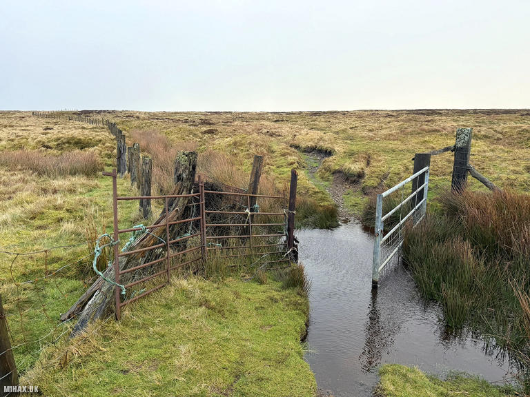
Access to Great Rhos requires careful route planning due to the Radnor Range explosives testing facility occupying Harley Dingle on the southern flanks. Unlike military training areas that publish firing times, this privately operated MOD-accredited facility maintains a permanent exclusion zone. The southern approaches that once provided the most direct route from New Radnor village now pass through restricted areas following a significant danger zone extension in 2017-2018. Fortunately, northern approaches remain entirely clear of complications.
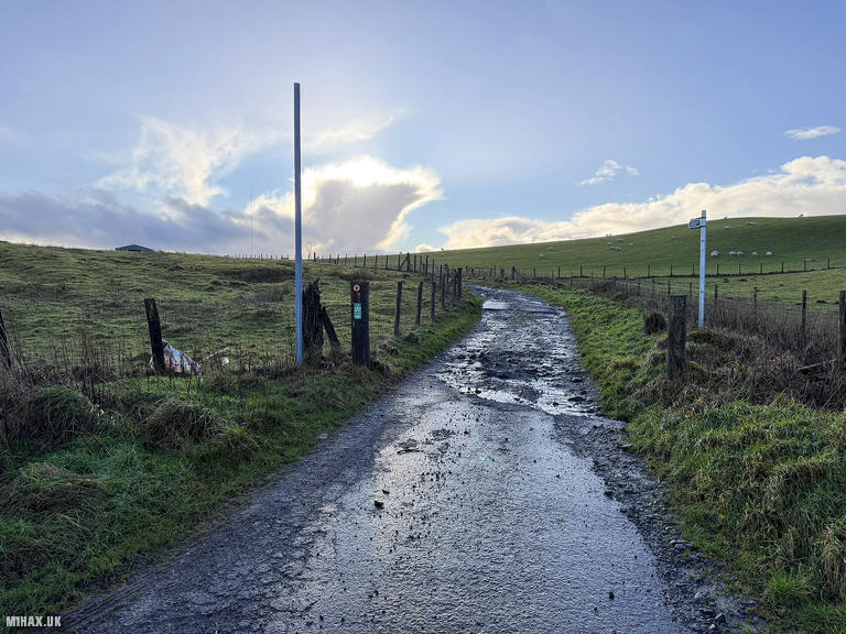
For this December activation, I chose the northern route, which begins with a drive up a short, narrow, steep tarmac road. Parking exists for two or three vehicles at the road end where a bridleway commences.
I was testing a new LoRa APRS UHF tracking device during this activation, which performed admirably thanks largely to GW4BML’s LoRa digipeater station providing coverage across the area. My primary motivation for exploring this northern route stemmed from previous parking difficulties on my earlier Great Rhos activation, the alternative access point offered space for barely one vehicle in muddy, cramped conditions. This northern approach provided far superior parking arrangements.
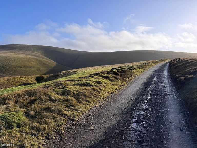
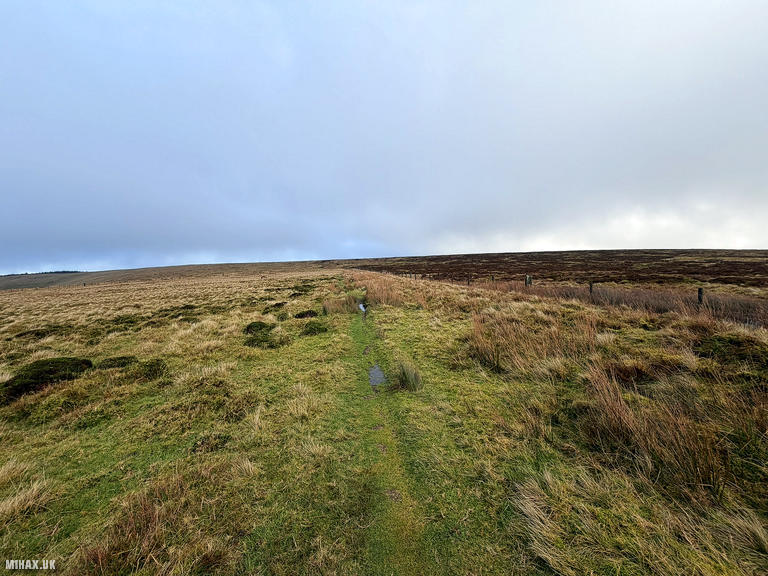
Following the bridleway southward, I eventually reached a junction where a left-hand turn departs from the main track. This intersection presents multiple route options, so careful navigation is essential to select the correct line. The only significant climb of the walk followed with a fairly steep ascent, though of relatively short duration. The grassy, rocky path climbed steadily until a fence line came into view ahead.
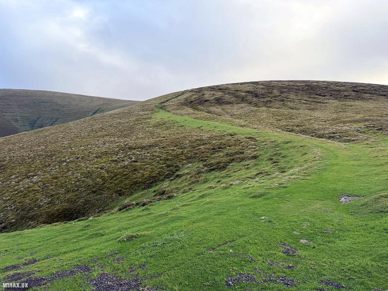
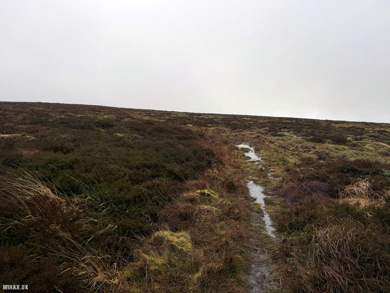
The obvious route would be to cross the fence and cut directly across the heather towards the trig point, but recent heavy rainfall deterred me from attempting this shortcut. Instead, I followed the clear path around the outside of the fence line, turning at a gate for the final ascent to the summit. Despite the recent deluge, the path I chose remained in good condition, keeping my feet dry throughout.
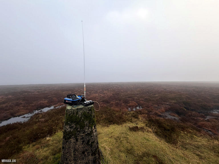
Reaching the trig point at 660 metres, I immediately encountered the challenging conditions that would define this activation. A strong wind blew relentlessly across the exposed plateau, making station setup and operation slightly uncomfortable. My plan was to use a long wire and mast pole for this activation but it was simply too windy to be sensible.
Setting up my Elecraft KX2 with the Elecraft AX1 vertical antenna, I began operating on 20 metres SSB. The conditions proved excellent for HF propagation, and I quickly worked through a productive run of European stations spanning Spain, Poland, Italy, Germany, Sweden, Finland, Switzerland, and France. Two summit-to-summit (S2S) contacts were made with M8BIA/P on G/SP-004 and OE5REO/P on an Austrian summit OE/OO-353. The highlight came with DX contacts to K2UPD and W1OW in the United States. I completed one final contact on 17 metres SSB with SOTA guru SQ9MDF before the cold and wind persuaded me to pack away.
With 26 contacts logged and the winter bonus points secured for this December activation, I retraced my route back down the grassy path, past the gate, and along the fence line to rejoin the bridleway. The return journey proved straightforward, though the wind continued to buffet across the open moorland. Total distance covered came to 9.2 kilometres with 270 metres of ascent over two and a half hours, a satisfying winter activation on Radnorshire’s highest summit.
Photos
Below are some photographs taken during my activation of Great Rhos on Friday 19th December, 2025.

Walking Route for Great Rhos
The interactive map below shows my GPS track taken to the SOTA activation zone for Great Rhos. The GW/MW-002 summit area is marked on the map with a blue pin icon.
You can download the route shown above as a GPX file suitable for use with most GPS devices. This file is provided for information only, to support your own walk planning and research (it may contain navigation errors, detours and/or safety hazards). The route downloads provided here are governed by the Creative Commons BY-NC-SA 4.0 licence.
Station Log
I logged the following 26 amateur radio contacts operating as MW1HAX/P from GW/MW-002 Great Rhos on Friday 19th December, 2025 (all times shown are UTC):
| Time | Callsign | Band | Mode | Notes |
|---|---|---|---|---|
| 11:51 | EA1DHB | 20m | SSB | RSTr: 59, RSTs: 57 |
| 11:52 | EA3EVL | 20m | SSB | RSTr: 59, RSTs: 52 |
| 11:52 | SQ9CWO | 20m | SSB | RSTr: 57, RSTs: 57 |
| 11:53 | EA7GV | 20m | SSB | RSTr: 52, RSTs: 56 |
| 11:53 | IK4IDF | 20m | SSB | RSTr: 59, RSTs: 58 |
| 11:54 | DK0PT | 20m | SSB | RSTr: 55, RSTs: 56 |
| 11:55 | SM5LNE | 20m | SSB | RSTr: 57, RSTs: 55 |
| 11:55 | EA2DT | 20m | SSB | RSTr: 57, RSTs: 58 |
| 11:56 | IN3NJB | 20m | SSB | RSTr: 55, RSTs: 58 |
| 11:58 | M8BIA/P | 20m | SSB | RSTr: 44, RSTs: 41, S2S G/SP-004 |
| 11:59 | K2UPD | 20m | SSB | RSTr: 55, RSTs: 57 |
| 12:00 | SM3NRY | 20m | SSB | RSTr: 57, RSTs: 57 |
| 12:01 | CT1EHX | 20m | SSB | RSTr: 55, RSTs: 59 |
| 12:02 | HB9CYV | 20m | SSB | RSTr: 57, RSTs: 58 |
| 12:02 | EA1BUL | 20m | SSB | RSTr: 57, RSTs: 59 |
| 12:03 | W1OW | 20m | SSB | RSTr: 57, RSTs: 57 |
| 12:04 | EA1GKP | 20m | SSB | RSTr: 55, RSTs: 52 |
| 12:05 | OH3GZ | 20m | SSB | RSTr: 59, RSTs: 56 |
| 12:05 | EA5K | 20m | SSB | RSTr: 55, RSTs: 59 |
| 12:06 | DL3OBW | 20m | SSB | RSTr: 57, RSTs: 57 |
| 12:07 | OE5REO/P | 20m | SSB | RSTr: 55, RSTs: 55, S2S OE/OO-353 |
| 12:08 | F4ABI | 20m | SSB | RSTr: 58, RSTs: 57 |
| 12:09 | DJ5NJ | 20m | SSB | RSTr: 55, RSTs: 55 |
| 12:10 | EA5IIG | 20m | SSB | RSTr: 57, RSTs: 58 |
| 12:11 | DG2BX | 20m | SSB | RSTr: 55, RSTs: 59 |
| 12:13 | SQ9MDF | 17m | SSB | RSTr: 57, RSTs: 58 |
In the notes field I will usually log the other operator’s name and the signal report they provided. In accordance with the Summits on the Air rules, I do not make a log entry where a complete exchange of callsigns and signal reports was unsuccessful.
Additional Information
The following resources may be helpful to walkers, mountaineers and SOTA activators interested in Great Rhos:
- Sotl.as Summit Page for GW/MW-002 Great Rhos.
- Hill Bagging UK Summit Page for Great Rhos.
- Google Maps Page for Great Rhos.
- Wikipedia entry for Great Rhos.
If you found this content valuable, why not Buy Me a Coffee?