Glasgwm - GW/NW-015 SOTA (2025)
Summits on the Air Activation Report
Activation Date: Friday 22nd August, 2025.
Activator(s): Richard M1HAX.
Summit: Glasgwm, North Wales, Wales.
Summit ID: SOTA reference GW/NW-015 (6 points).
Summit Height: 779m elevation, 215m prominence.
Summit Location: Lat./Long. 52.76015, -3.72528. Maidenhead Grid IO82ds.
Also Activated: GW/NW-007.
Distance: 15.8km travelled with 1025m of ascent.
Difficulty: SAC Grade T1.(?)
Elapsed Time: 5h 10m (incl. operating and other summit(s) on the same hike).
Weather: 9°C, cloudy, 4 kph N wind, 93% humidity.
Radio Equipment: Yaesu VX6, Slim-J.
Callsign Used: MW1HAX/P.
Contacts: 8 (2m FM).
Trip Notes
Glasgwm, standing at 779 metres in the Aran range of southern Snowdonia, forms part of one of Wales' most remote and impressive mountain landscapes. This Marilyn summit, with its distinctive conical cairn, offers commanding views across the wild country of Meirionnydd and provides an excellent approach to the higher peaks of the Aran ridge.
Access to Glasgwm has evolved in recent years. My previously used north-western approach from Rhydymain village has been rendered impassable due to extensive forestry operations, with activator David GW0EVV reporting in 2024 that the area between the forest road and fellside gate was severely affected by harvesting activity, with very muddy tracks and scattered brash requiring good boots and gaiters. This has prompted hikers to consider alternative routes.
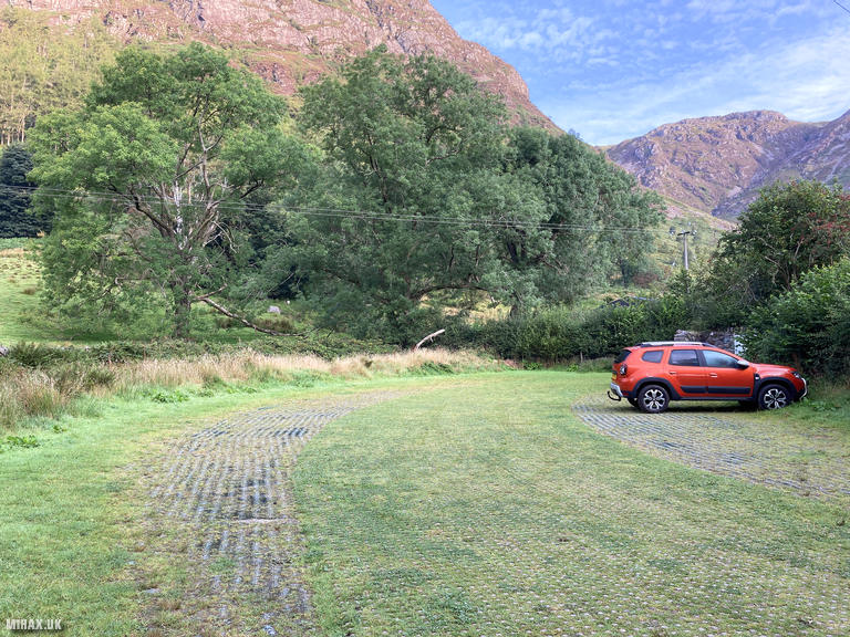
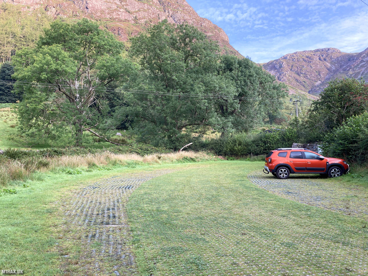
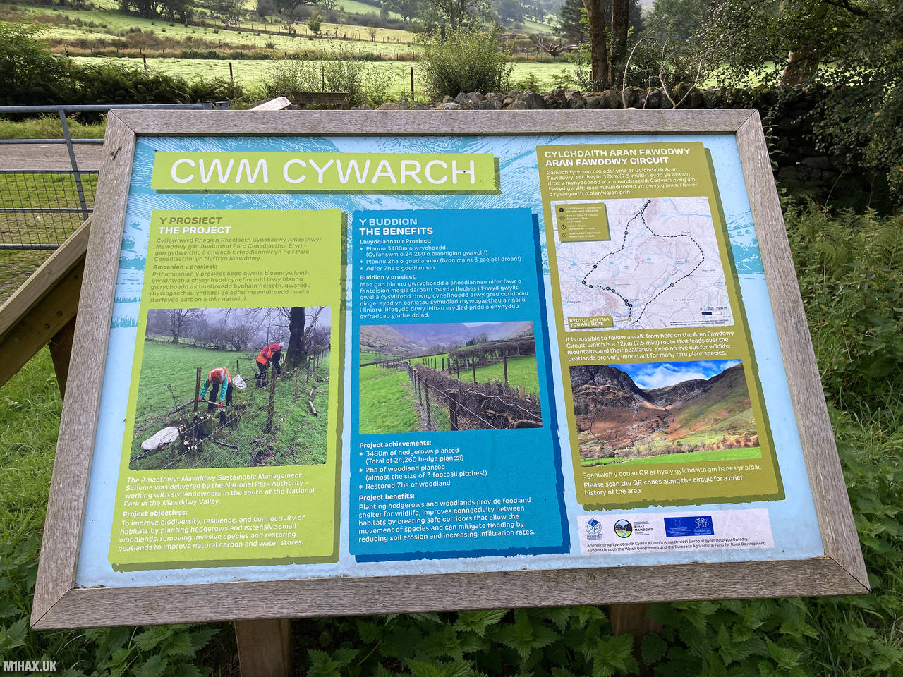
For this activation, I opted to try the south-eastern approach from Cwm Cywarch, a route previously documented by Robert M0RWX via the SOTA Mapping Project. The spacious car park at Cwm Cywarch provides excellent facilities including toilets and room for ten or more vehicles, accessed through a gate along a narrow rural road deep into this beautiful valley.
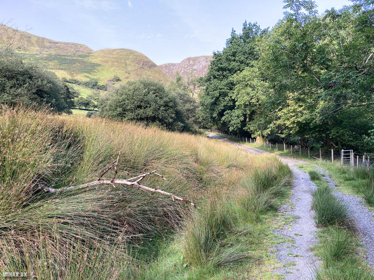
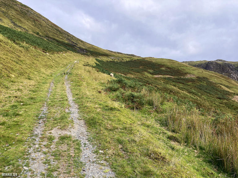
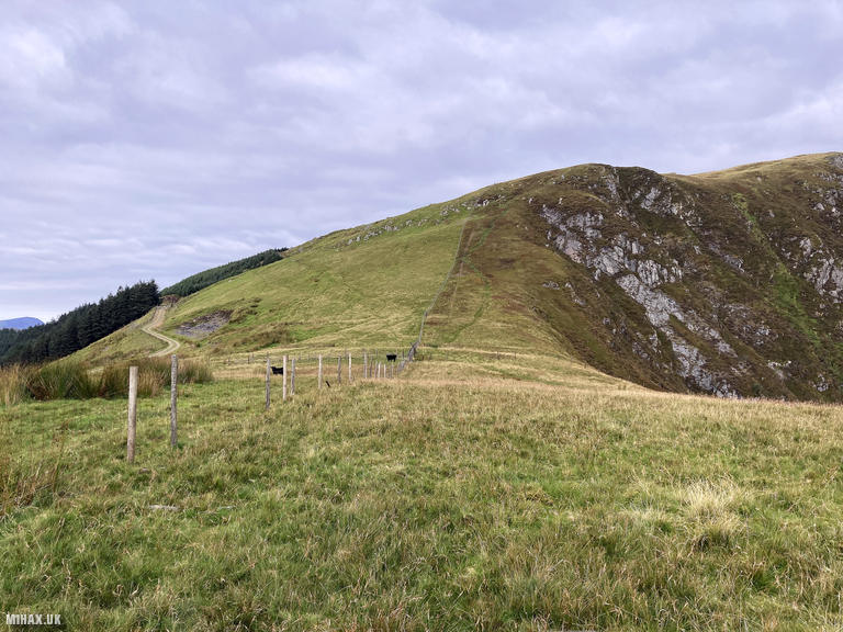
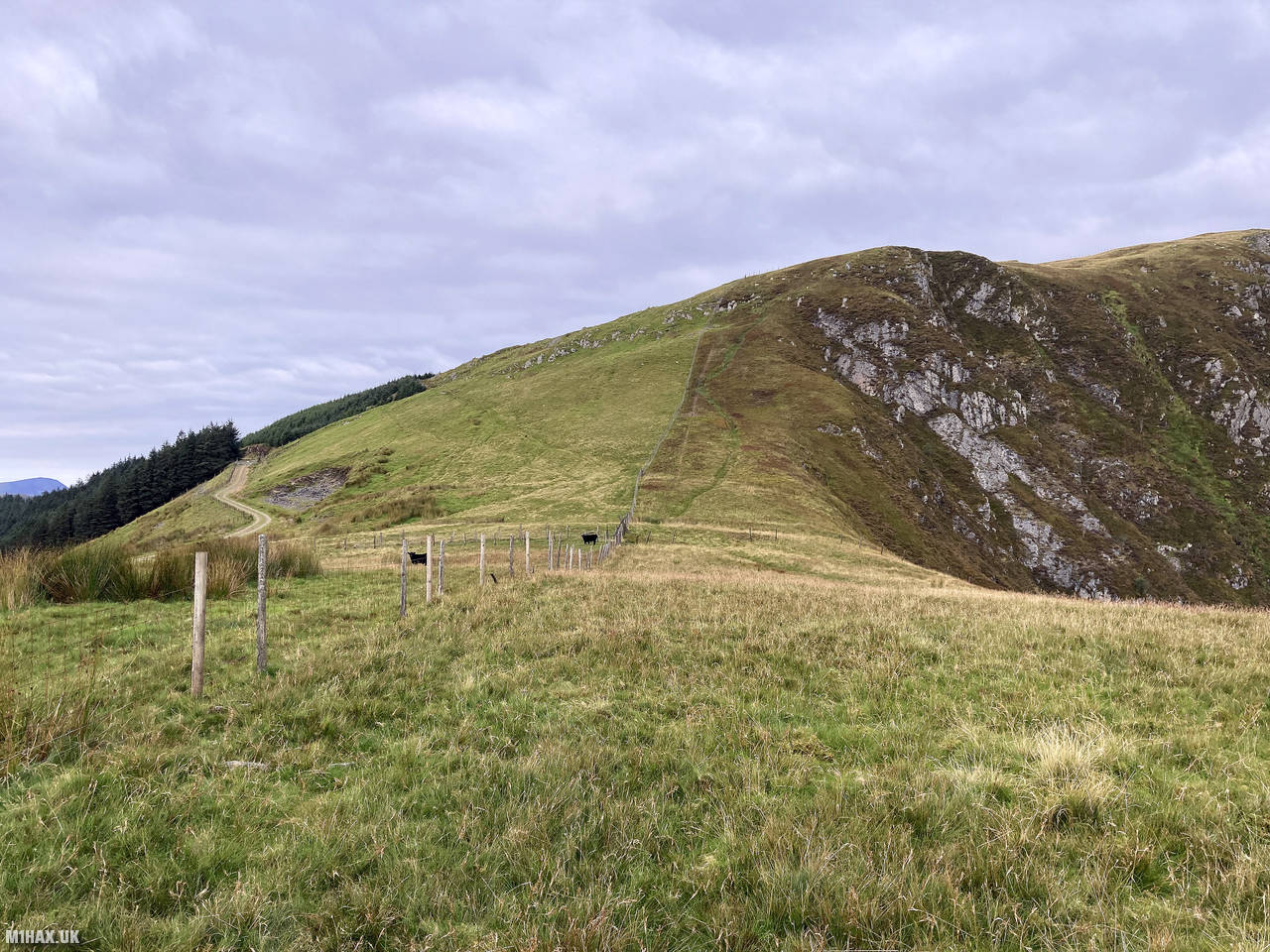
The route began by walking south along the road before turning west onto an obvious track that climbs steeply from the valley floor. This initial section gains height rapidly, eventually levelling out as the upper slopes of Glasgwm are reached. Along this stretch, numerous curious cows in the adjacent field watched proceedings with interest.
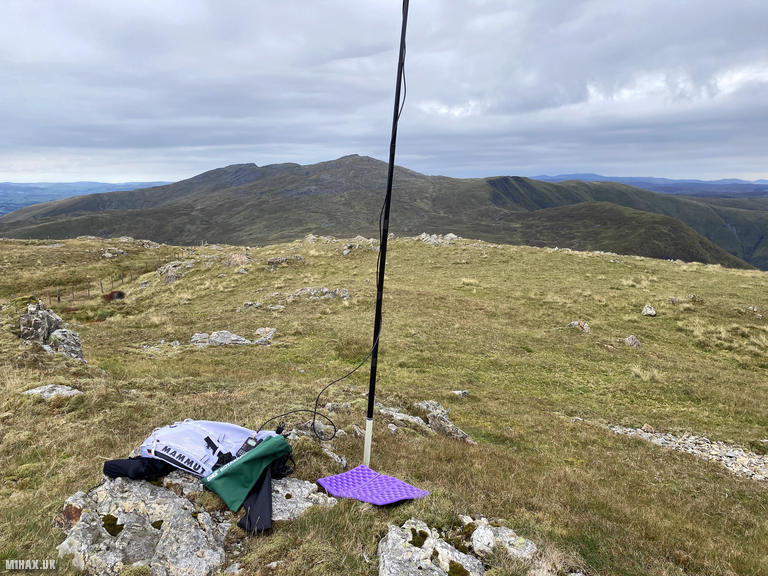
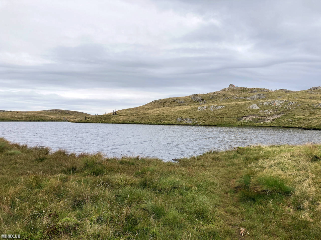
Turning north towards the summit, a grassy path leads directly to the top. The summit itself features a small lake beside the large conical cairn as noted in the Marilyn database. With several other hillwalkers visiting the summit, I set up my radio station a short distance away from the cairn to avoid causing disruption.
Operating my Yaesu VX6 handheld at 5 watts with a slim-jim antenna mounted on a fishing pole proved remarkably effective on the 2-metre band. I completed eight contacts, including three satisfying summit to summit (S2S) contacts - with GW4TQE/P on Gyrn Moelfre (GW/NW-049), and with both 2W1RTB/P and MW7MWZ operating together from Foel Goch (GW/NW-039).
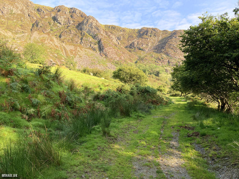
After packing away my equipment, I descended northeast following the same route I’ve used on previous visits to these mountains. I was pleased to discover that sections of the path which were previously severely boggy have been repaired with gravel since my last visit, making the descent towards Aran Fawddwy considerably more pleasant.
This circular route from Cwm Cywarch proves vastly superior to the now difficult Rhydymain approach, offering good paths, free parking with facilities, and access to both Glasgwm and the higher parts of the Aran ridge. I would certainly recommend this route for future activations.
Photos
Below are some photographs taken during my activation of Glasgwm on Friday 22nd August, 2025.


Walking Route for Glasgwm
The interactive map below shows my GPS track taken to the SOTA activation zone for Glasgwm. Note that this summit was activated as part of a multi-summit hike and the map below shows the full route taken on the day. The GW/NW-015 summit area is marked on the map with a blue pin icon.
You can download the route shown above as a GPX file suitable for use with most GPS devices. This file is provided for information only, to support your own walk planning and research (it may contain navigation errors, detours and/or safety hazards). The route downloads provided here are governed by the Creative Commons BY-NC-SA 4.0 licence.
Station Log
I logged the following 8 amateur radio contacts operating as MW1HAX/P from GW/NW-015 Glasgwm on Friday 22nd August, 2025 (all times shown are UTC):
| Time | Callsign | Band | Mode | Notes |
|---|---|---|---|---|
| 08:43 | GW0PLP | 2m | FM | RX: 59, TX: 59 |
| 08:44 | GW4BML | 2m | FM | RX: 59, TX: 59 |
| 08:46 | GW4TQE/P | 2m | FM | RX: 59, TX: 59, S2S GW/NW-049 |
| 08:47 | 2W1RTB/P | 2m | FM | RX: 59, TX: 59, S2S GW/NW-039 |
| 08:48 | MW7MWZ | 2m | FM | RX: 59, TX: 59, S2S GW/NW-039 |
| 08:49 | M7WUK | 2m | FM | RX: 59, TX: 59 |
| 08:50 | G0RQL | 2m | FM | RX: 41, TX: 53 |
| 08:55 | M0ZXQ | 2m | FM | RX: 56, TX: 59 |
In the notes field I will usually log the other operator’s name and the signal report they provided. In accordance with the Summits on the Air rules, I do not make a log entry where a complete exchange of callsigns and signal reports was unsuccessful.
Additional Information
The following resources may be helpful to walkers, mountaineers and SOTA activators interested in Glasgwm:
- Sotl.as Summit Page for GW/NW-015 Glasgwm.
- Hill Bagging UK Summit Page for Glasgwm.
- Google Maps Page for Glasgwm.
- Wikipedia entry for Glasgwm.
If you found this content valuable, why not Buy Me a Coffee?