View Edge - G/WB-018 SOTA (2021)

Summits on the Air Activation Report
Activation Date: Saturday 12th June, 2021.
Activator(s): Richard M1HAX.
Summit: View Edge, Welsh Borders, England.
Summit ID: SOTA reference G/WB-018 (1 point).
Summit Height: 321m elevation, 167m prominence.
Summit Location: Lat./Long. 52.42383, -2.85020. Maidenhead Grid IO82nk.
Distance: 0.1km travelled with 1m of ascent.
Difficulty: Drive on summit.
Elapsed Time: 15m (including operating).
Weather: 20°C, 8 mph WNW wind, 58% humidity.
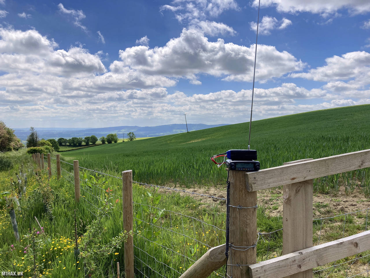
Radio Equipment: Yaesu FTM100D, MFJ-1714, Zippy 4200mAh 4S LiFePo4.
Callsign Used: M1HAX/P.
Contacts: 5 (2m FM).
Trip Notes
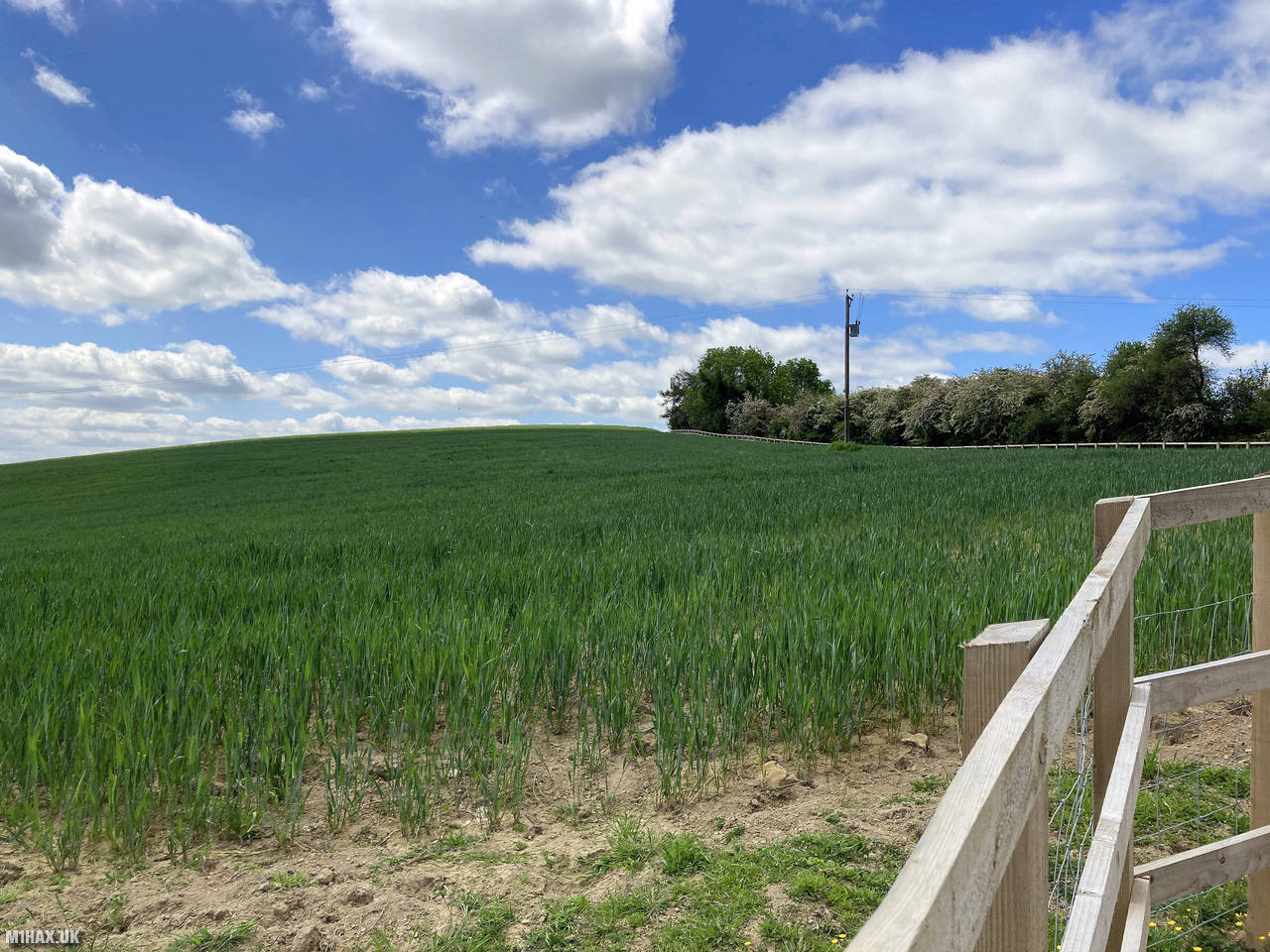
View Edge is a modest hill located in the Shropshire Hills National Landscape area, with an elevation of 321 metres. Unlike many SOTA summits, View Edge is notable for being what is commonly referred to as a “drive-on summit” - where the public road passes within the SOTA activation zone.
This summit activation was part of my day trip activating five one-point hills in the Shropshire Hills area: Caer Caradoc Hill, Heath Mynd, Burrow, View Edge, and Callow Hill. View Edge was the second summit I targeted on this full day of hills.
Finding the activation location was straightforward, as the summit is right by a road. I found a small roadside parking spot suitable for only one car, and fortunately it was free when I arrived. The location is quite rural with minimal traffic.
View Edge is a small and somewhat indistinct hill. The immediate summit area is not designated as public access land, and there are no footpaths that traverse the true summit. The public road, however, passes within the SOTA activation zone (which extends 25 vertical metres below the actual summit).
Operating from the roadside was perfectly adequate for a valid SOTA activation. I used a newly erected fence by the road as a support for my Yaesu FTM100D and MFJ vertical antenna. This improvised setup worked well for this quick activation.
I was able to make five contacts on the 2-metre band in under 10 minutes. Propagation seemed reasonable for this modest elevation, and two mobile stations were among those I managed to work.
Given that I had three more summits planned for the day, I kept this activation brief. After logging the minimum four contacts required for a valid SOTA activation (plus one more for good measure), I packed up my equipment and left for my next destination, Burrow.
In total, this activation took only about 15 minutes from arrival to departure - showing how SOTA can accommodate different levels of accessibility and time commitment. While not the most scenic or challenging summit in the program, View Edge provided a quick and convenient one point toward my 2021 SOTA activator score.
Photos
Below are some photographs taken during my activation of View Edge on Saturday 12th June, 2021.


Station Log
I logged the following 5 amateur radio contacts operating as M1HAX/P from G/WB-018 View Edge on Saturday 12th June, 2021 (all times shown are UTC):
| Time | Callsign | Band | Mode | Notes |
|---|---|---|---|---|
| 10:16 | G4ROR | 2m | FM | Derrick, 5/5 |
| 10:18 | G1IVL/M | 2m | FM | Richard, 4/3 |
| 10:19 | M0KYX/M | 2m | FM | Ian, 5/9 |
| 10:21 | G4HQB | 2m | FM | Phil, 5/9 |
| 10:24 | M6OTN | 2m | FM | Tim, 5/9 |
In the notes field I will usually log the other operator’s name and the signal report they provided. In accordance with the Summits on the Air rules, I do not make a log entry where a complete exchange of callsigns and signal reports was unsuccessful.
Additional Information
The following resources may be helpful to walkers, mountaineers and SOTA activators interested in View Edge:
- Sotl.as Summit Page for G/WB-018 View Edge.
- Hill Bagging UK Summit Page for View Edge.
- Google Maps Page for View Edge.
- Wikipedia entry for View Edge.
If you found this content valuable, why not Buy Me a Coffee?